List of Michigan State Historic Sites in Mackinac County
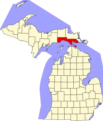
The following is a list of Michigan State Historic Sites in Mackinac County, Michigan. Sites marked with a dagger (†) are also listed on the National Register of Historic Places in Mackinac County, Michigan. Those with a double dagger (‡) are also designated National Historic Landmarks.[1]
Current listings
| Name | Image | Location | City | Listing date |
|---|---|---|---|---|
| Agency House Informational Site | Huron Street | Mackinac Island | February 12, 1959 | |
| Agency House of the American Fur Company† | 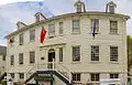
|
7342 Market Street | Mackinac Island | March 23, 1965 |
| American Fur Company Store / Beaumont Memorial Informational Site | 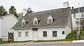
|
Market Street at Fort Street | Mackinac Island | 2003 |
| Battlefield of 1814 Informational Site | 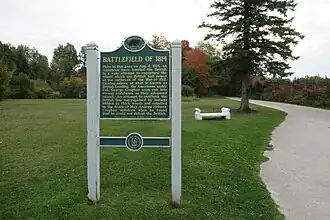
|
Near Wawashkamo Golf Club, on British Landing Road | Mackinac Island | March 19, 1958 |
| Biddle House | 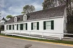
|
Market Street | Mackinac Island | July 19, 1956 |
| Bois Blanc Island Informational Designation | 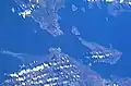
|
Ferry Docks | Pointe Aux Pins | May 10, 1990 |
| Bois Blanc Lighthouse | 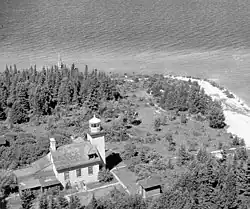
|
Lighthouse Point (north end of island) | Bois Blanc Island | July 26, 1974 |
| British Cannon Informational Site | 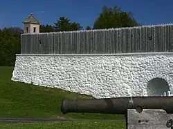
|
Rear of Fort Mackinac, high ground north of the fort | Mackinac Island | February 12, 1959 |
| British Landing Informational Site | 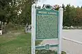
|
Northwest shore of Mackinac Island | Mackinac Island | March 19, 1958 |
| Ambrose R. Davenport House | 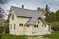
|
North Street, Hubbard's Annex | Mackinac Island | June 30, 1988 |
| Davis-Preston House | 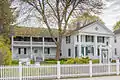
|
6806 Huron Street | Mackinac Island | May 17, 1978 |
| Early French Missionary Chapel | .jpg)
|
Fort Street, north of Main, near sidewalk to fort | Mackinac Island | May 1, 1959 |
| Epoufette Informational Site | 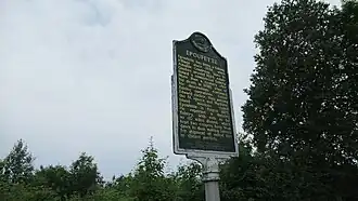
|
US 2 scenic turnout overlooking Epoufette Bay | Epoufette | July 23, 1985 |
| Fort De Buade Informational Site | 
|
State Street | St. Ignace | September 25, 1956 |
| Fort Holmes Informational Site | 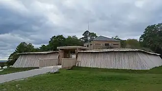
|
Fort Holmes Road, north of the business district | Mackinac Island | September 25, 1956 |
| Historic Fort Mackinac† | 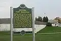
|
Huron Road | Mackinac Island | February 19, 1958 |
| Mathew Geary House† | 
|
Market Street | Mackinac Island | February 11, 1970 |
| Grand Hotel‡ | 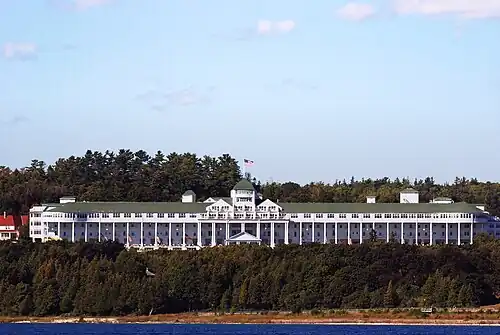
|
Grand Hotel Avenue | Mackinac Island | July 12, 1957 |
| Gros Cap and St. Helena Island Informational Site | 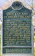
|
Park on US 2, 6 miles west of St. Ignace | St. Ignace vicinity | January 19, 1961 |
| Gros Cap Cemetery† | 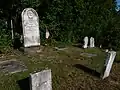
|
SE of Gros Cap on US 2 | Gros Cap vicinity | November 6, 1970 |
| High Rollway Informational Designation | Lake Michigan Shore, between Brevort and Epoufette | Moran Township | May 11, 1965 | |
| Hubbard's Annex to the National Park Informational Designation | 
|
Park Ave at Grand Ave | Mackinac Island | 2014 |
| Indian Dormitory† / Henry R. Schoolcraft Informational Designation | .jpg)
|
Huron Street, next to Marquette Park | Mackinac Island | February 17, 1965 |
| Island House | 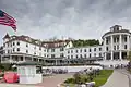
|
6966 Main | Mackinac Island | March 14, 1973 |
| Lake Michigan Informational Designation | 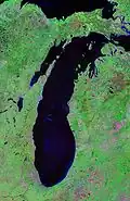
|
US 2 west of St. Ignace, near Gros Cap | St. Ignace vicinity | January 19, 1957 |
| Lake View House | .jpg)
|
7452 Main St | Mackinac Island | January 13, 1982 |
| Little Stone Church | 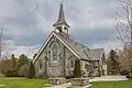
|
1590 Cadotte Street | Mackinac Island | March 28, 1979 |
| Mackinac Conference Informational Site | 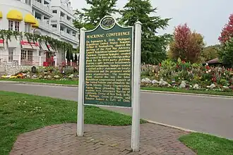
|
Grounds of the Grand Hotel | Mackinac Island | August 15, 1975 |
| Mackinac Island‡ / Mackinac Island Informational Designation | 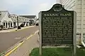
|
Market Street | Mackinac Island | July 19, 1956 |
| Mackinac Straits Informational Designation | 
|
I-75 Rest Area and Visitors Center, just north of Mackinac Bridge exit | St. Ignace vicinity | August 23, 1956 |
| Manitou Lodge† | Hiawatha Sportsman's Club, Museum Trail off US 2 Garfield Township | Naubinway | January 23, 1997 | |
| Market Street Informational Designation | 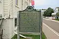
|
Market Street | Mackinac Island | July 19, 1956 |
| Mission Church† | .jpg)
|
Huron Street, corner of Truscott Street | Mackinac Island | July 19, 1956 |
| Mission House† | 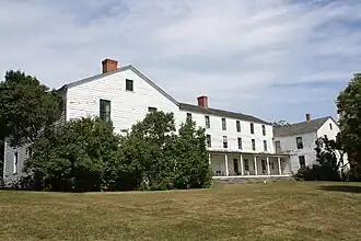
|
6633 Main St | Mackinac Island | November 6, 1970 |
| Northernmost Point of Lake Michigan Informational Designation | 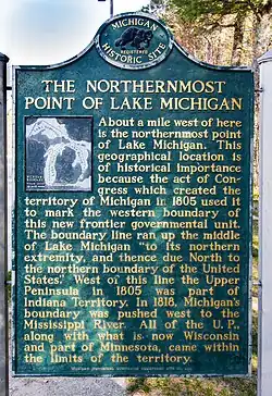
|
Roadside park on US 2, 3 miles east of Naubinway | Naubinway vicinity | April 14, 1964 |
| Parade Grounds / Scouts Barrack Informational Designation | 
|
Huron Road just east of Fort Mackinac | Mackinac Island | 2015 |
| Portage Road Informational Designation | Roadside Park on US 2, just west of St. Ignace, near intersection of Old Portage Road | St. Ignace vicinity | April 11, 1963 | |
| Round Island Lighthouse Informational Designation† | 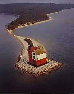
|
Foot of Huron Street, next to the Iroquois Hotel, in the municipal park overlooking the lighthouse | Mackinac Island | April 23, 1971 |
| St. Ignace Informational Designation | 
|
State Ferry Dock No. 1 | St. Ignace | July 19, 1956 |
| Sainte Anne Church | .jpg)
|
Huron Street at the corner of Church Street | Mackinac Island | December 20, 1990 |
| Silver Birches | On M-185, NE part of the island | Mackinac Island | September 8, 1982 | |
| Skull Cave | .jpg)
|
Garrison Road | Mackinac Island | January 12, 1959 |
| St. Ignace Mission‡ | 
|
Marquette Park, Marquette and State Streets | St. Ignace | August 23, 1956 |
| Robert Stuart House |
|
7342 Market Street | Mackinac Island | June 23, 1983 |
| Trinity Episcopal Church | 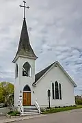
|
Fort Street | Mackinac Island | July 11, 1968 |
| USCG Maple W-234 | Harbor | Mackinac Island | July 15, 1999 | |
| Wawashkamo Golf Club | 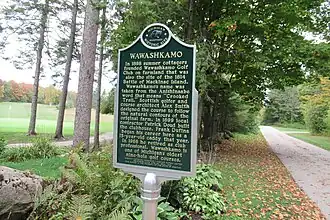
|
British Landing Road | Mackinac Island | September 8, 1982 |
| G. Mennen Williams Summer Home | West Bluff | Mackinac Island | January 19, 1978 | |
| Lawrence Andrew Young Cottage† | 
|
Huron Road | Mackinac Island | October 21, 1975 |
See also
Sources
- Historic Sites Online – Mackinac County. Michigan State Housing Developmental Authority. Accessed May 12, 2011.